 |
| "Lost" New England Revealed by High-Tech Archeology |
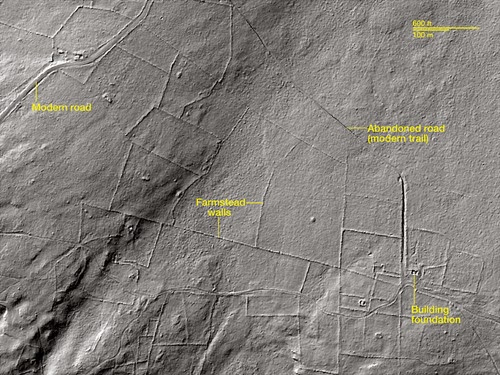
New England’s woody hills and dales hide a secret—they weren’t always forested. Instead, many were once covered with colonial roads and farmsteads. This “lost” New England of the colonial era has started to emerge, thanks to archeologists piercing the forests with the latest in high-tech scanners, called light detection and ranging (LiDAR). In the images above, LiDAR reveals farm walls, roads and homesteads hidden within Connecticut’s Pachaug State Forest. Dating to the 18th Century, the farmsteads were abandoned in the 1950’s. The airborne technology bounces laser light pulses off the ground to generate precise pictures of surface features. A quiet revolution in archeology has resulted from LiDAR’s advent, with scholars making new discoveries by using the technology to look at Maya cities, Stonehenge’s plains, and Renaissance palaces, among other places. Read more.
"Lost" New England Revealed by High-Tech Archeology
No comments:
Post a Comment